HEALTH
Italian Institute of Technology explores satellite data using AI to discover hidden archaeological sites
The Cultural Landscapes Scanner pilot project will exploit Artificial Intelligence to detect the archaeological heritage of the subsoil. The project will last three years and will be carried out by IIT in collaboration with the European Space Agency
Today in Venice, Italy, the "Cultural Landscapes Scanner" (CLS) project has been launched from the collaboration between Istituto Italiano di Tecnologia (IIT- Italian Institute of Technology) and the European Space Agency (ESA) in order to detect archaeological sites from above by analyzing satellite images through artificial intelligence (AI). IIT's researchers of the Centre of Cultural Heritage Technology, led by Arianna Traviglia, will introduce AI to help archaeologists trace back the ancient presence of humans by revealing hidden traces in the soil. The AI will be able to recognize even minimal or imperceptible variations in vegetation or other particular signs of the surface that may indicate the presence of remains not yet discovered. The project will last three years and may have as an immediate outcome an improved capacity of identifying cultural heritage sites at risk of looting. 
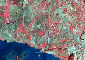
In the last decades, the identification of sub-surface cultural heritage sites has taken advantage of Remote Sensing data, a way of detecting that allows to find buried objects in the sub-soil through images in which is possible to recognize subsoil archaeological deposits from anomalies and traces in bare soils, crops or vegetation. Arianna Traviglia's previous studies have already investigated the potential advantages of developing automated remote sensing, but they have also shown that the current technologies have some limits, being able to detect only very specific objects. In this scenario, web platforms of free remote sensing datasets have known exponential growth and they are amply used by the Cultural Heritage community around the world. Among them, there is Copernicus, the free and open satellite data platform for Earth observation coordinated by the European Commission in partnership with ESA.
However, the visual analysis of data coming from these platforms is extremely complex due to a large amount of data to be managed and because the images must be viewed and human interpreted. For this reason, the real challenge for Traviglia's research group is to add machine learning and computerized artificial vision in order to make this job much easier. The group is one of the few in the world that has designed algorithms for automatic detection of archaeological and cultural heritage sites.
The "Cultural Landscapes Scanner" (CLS) project will have, thus, an innovative approach aiming to overcome the current methods based on subjective observation, making possible a wider and more precise detection thanks to advanced computational methods.
Researchers will define a broad spectrum, adaptable and robust automated recognition procedure, customized for cultural heritage sites using the tele data obtained from the Copernicus platform. Automated Remote Sensing, via machine learning, will produce a more accurate detection of the cultural heritage objects through satellite imagery and clearer identification of ancient land division systems.
Machine learning algorithms can improve automatically by gaining experience in an incremental self-learning process. Therefore, AI will be able to offer an increasingly precise identification of potential underground archaeological sites.
This AI approach will be able to see objects or irregularities that are usually impossible to see for the human eye. The combination of these elements will produce the possibility to observe traces in the vegetation, bare soils, hollows, and crop marks. Thus, AI will support current photo-interpretation practices, based on subjective observations, thanks to its accuracy in analyzing images and the possibility to explore wider spatial areas. Another aspect that will surely profit from the development of Automated Remote Sensing is the increased possibility of cultural heritage preservation. In fact, an immediate outcome will be represented by an improved capacity of response to cultural threats identifying the cultural heritage sites at risk of looting.
